The Project
Environmental Impact Assessment
Lime Down Solar Park is classified as an Environmental Impact Assessment (EIA) development. This requires us to assess the potential significant environmental impacts of our proposed development, as mandated by the Infrastructure Planning (Environmental Impact Assessment) Regulations 2017.
EIA is the iterative process in which the assessment of environmental impacts is carried out in parallel with the development design process. We will use EIA as a tool to identify the potential effects Lime Down might have on the environment – benefits as well as negative impacts.
The purpose of the EIA process is to make sure that where we identify any significant effects, we put in place measures to reduce any negative impacts, while also seeking to enhance positive effects.
Our initial work has identified a number of environmental considerations which are informing the development of our detailed design for Lime Down Solar Park. A summary of these topics can be found on this webpage below.
EIA is broken down into many topics that we need to assess. These include:
Ecology and biodiversity
Landscape and visual
Cultural heritage
Transport and access
Soils and agriculture
Hydrology flood risk and drainage
Socio-economics, tourism and recreation
Noise and vibration
Climate change
Air quality
Health
Waste
For each of these topics we will assess the impact of the project on them throughout its lifecycle from construction through to operation and decommissioning.
The results of the EIA will be set out in the Environmental Statement (ES) which will be included in our final DCO application.
Measures to reduce effects
We have been getting to know the local environment through site visits, environmental surveys and desk-based information gathering. The results of this work helps shape our project design.
Findings from our ongoing assessments are important in determining the potential impacts the construction, operation and decommissioning of the Project could have on the landscape, environment and local communities. A summary of the initial results from our environmental surveys and assessments can be found in the Preliminary Environmental Information Report (PEIR) and have been summarised in the PEIR Non-technical summary available via our Documents webpage linked here. More detailed information is set out in topic specific chapters of the PEIR – Volume 1: Main Report.
Reducing or avoiding impacts is one of our top priorities. In developing our proposals for the Project, we have incorporated a range of measures to minimise its impacts on a range of different factors. A number of topic areas are listed below, with full details and further topic areas provided in the PEIR.
Stage 1: EIA Scoping
On 16 July 2024 we submitted an Environmental Impact Assessment (EIA) Scoping Report to the Planning Inspectorate (PINS). This is available on the PINS webpage for Lime Down Solar Park, linked here.
The purpose of EIA is to comprehensively identify and evaluate the likely significant effects of a proposed development on the environment so we can then determine measures to reduce or manage any likely significant adverse effects.
Production of a Scoping Report is the initial stage of the EIA process. It sets out the proposed scope of the EIA, and our submission of this Report to PINS formed a formal request for a Scoping Opinion under Regulation 10(1) of the EIA Regulations.
Our Scoping Report for Lime Down Solar Park included:
A description of the proposed development, including its location and technical capacity
A description of baseline information and further data to be obtained
The methodologies we will use to assess environmental factors
The proposed scope of the assessments we will carry out
Potential impacts of the Project and associated mitigation
An explanation of the likely significant effects of the development on the environment,
The approach to cumulative assessment.
Over a 42-day period, PINS consulted with various organisations, including the local authority, Statutory Environmental Bodies (SEBs) and other stakeholders with specific expertise and responsibilities related to environmental protection, to gather their views on the scope of the environmental assessment.
PINS then compiled the feedback received and on 22 July 2024 published its ‘Scoping Opinion’. This sets out comments on our proposed approach to EIA, and the topics we need to address in the Environmental Statement (ES) that will be submitted as part of our application for development consent.
A copy of the Scoping Opinion PINS provided us with can be found on the PINS website here.
Stage 2: Preliminary Environmental Information Report (PEIR)
We are required by the Planning Act 2008 to prepare a PEIR.
A core technical document, the PEIR sets out the initial findings of the EIA and identifies the measures we are proposing to reduce, enhance and improve the effects our proposed development may have on the environment.
The PEIR was presented at statutory consultation so technical stakeholders, local communities, individuals and interested parties can develop an informed view of the potential impacts Lime Down may have on the local environment and provide us with their views and feedback.
You can view the PEIR via the Documents – Stage Two Consultation – Jan 2025 webpage linked here.
Stage 3: Environmental Statement (ES)
The results of the EIA will be set out in the ES.
This is being prepared based on the Scoping Opinion and advances the content of the PEIR, incorporating feedback received during statutory consultation and the outcomes of our assessments undertaken.
The ES will describe any changes to the project and the measures we are proposing to implement to reduce, improve or enhance the impacts of the project
The ES, along with a Non-Technical Summary (NTS) will form part of the DCO application we submit to PINS.

-
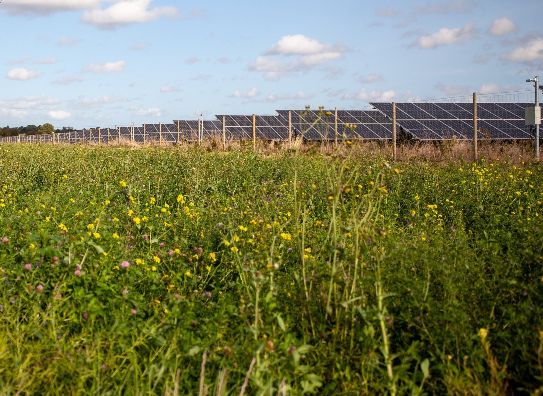
Detailed survey work is being carried out to understand where and what wildlife is currently found across the site so we can identify the potential impacts of our proposals on local species, as well as ways we can protect, promote and enhance wildlife habitats in our plans. These will include:
Breeding bird surveys
Bat surveys
Badger surveys
Great Crested Newt Surveys
Water vole and otter surveys
We are proposing a range of buffers to avoid impacts on ditches, watercourses, ponds, woodland, hedgerows, trees, designated sites and badger setts, bat roosts and nesting sites.
We propose using a technique called Horizontal Directional Drilling (HDD) for sections of the grid connection route. This involves drilling underground rather than digging open trenches, helping to avoid disturbing priority or sensitive habitats.
-
A full Landscape and Visual Impact Assessment will be produced so we can identify any potential visual impacts associated with the development we’re proposing and put in place appropriate measures to reduce them. For example, views of equipment could be screened by enhancing existing hedgerows and planting new ones.
We are also committed to going beyond the requirements and plan to undertake a Residential Visual Amenity Assessment which seeks to mitigate potential impacts on private views and amenity. Where appropriate, we will propose bespoke measures to visually reduce the potential impacts of the development for each of the properties that may be impacted.
The Project will be designed to integrate within the landscape and existing vegetation patterns, sensitively aligning with the local landscape characteristics wherever possible.
The design will incorporate minimum offsets from existing landscape features, including residential properties, ancient woodland, woodland and hedgerows, public rights of way and watercourses.
-
We recognise the cultural and historical importance of this area of Wiltshire, and are carrying out studies to fully understand the significance of heritage assets in the surrounding area, such as Listed Buildings, Conservation Areas and Scheduled Monuments.
We have undertaken site visits and desk-based assessment to understand the heritage value of the site, and will carry out detailed ground investigation and archaeological surveys to ensure that any assets are protected and avoided during the construction phase of the project. We will also be undertaking field walking and a geo-physical survey of the entire project area to get a better understanding of the potential for buried archaeology.
We have designed the grid connection route and the Solar PV Sites to avoid direct impacts on archaeologically sensitive areas. Some panels have been entirely removed as a result of archaeological or heritage sensitivities.
To minimise such impacts as far as possible, we are proposing measures such as trenchless construction techniques, appropriate routing of vehicles and avoidance of archaeological remains preserved below ground wherever this is practicable.
-
We are evaluating traffic and access considerations, and have undertaken initial site visits to identify the existing access points into Lime Down Solar Park. We will assess the potential impact of our proposals on traffic, and produce a Construction Traffic Management Plan to outline how we will minimise impact on local traffic during construction and operation.
-
We are carrying out surveys on the agricultural land within the area to identify its Agricultural Land Classification (ALC) grading. ALC is a framework for classifying land according to its quality and long-term agricultural use. The framework uses a ‘grading’ system to assess its quality – Grade 1 being the highest quality land, and Grade 5 being the lowest. Best and Most Versatile (BMV) land is graded between 1 to 3a, meaning land ranges from ‘excellent’ to ‘good’ quality land. Non-BMV landed is graded from 3b to 5.
Soil and ALC surveys have been completed across most of the Solar PV Sites, BESS Area and substation areas. We are continuing to survey land to the west of the ‘Lime Down C’ site. Final survey results will be contained within the Environmental Statement to be submitted with the DCO application. 70% of the land surveyed for Lime Down Solar Park so far is non-BMV land. PEIR Volume 1, Chapter 17: Soils and Agriculture provides a more detailed overview of likely effects as a result of the Project.
Impacts our Project would have on farmable areas are reversible, and our plans include restoring the land to its original use and condition as far as practicable. Where BMV land is included in the Project, we have worked closely with farmers to use their least productive land where we can.
During the lifespan of the Project, some agricultural land would not be used for arable crops. As land within the Solar PV Sites would be largely undisturbed during this time, there would be the opportunity for improvements in the health, quality, and structure of soil.
In refining the Project’s design, we have sought to locate access tracks, compounds and substation on the lowest quality land available within each parcel. A number of management plans will also be in place to help manage and reduce impacts from the Project. For example, an Outline Soil Management Plan will focus on reducing soil impacts and will include measures for us to monitor the land and soil during construction, operation, maintenance, and decommissioning (when the Project is taken out of service).
-
Emerging flood risk findings from initial research we have carried out indicate that the majority of the project area is located within Flood Zone 1 which is classified as having a ‘low’ risk to flooding. Parts of the Lime Down sites (D and E) are located within Flood Zones 2 and 3, so we will prepare a Flood Risk Assessment in line with the requirements of National Policy Statement for Energy guidance.
Further, we have also identified land between parts of Lime Down sites (B and C) located within Flood Zones 2 and 3.
Additionally, we will conduct a drainage assessment that describes baseline land drainage conditions and existing site runoff rates, also producing a concept strategy for managing site runoff during the operational lifetime of the development, including resilience to climate change.
We are proposing eight metre buffers around watercourses, flood-resilient service cabling, and will keep construction activities away from watercourses and drainage ditches. New access tracks will be designed to be permeable, and temporary drainage systems may also be installed during the construction phase to manage runoff and prevent blockages.
There are no significant residual effects for flood risk and water resources during the construction, operation and decommissioning. The assessment will be reviewed and revised where necessary ahead of submission.
-
We recognise the need to deliver Lime Down Solar Park sensitively and make sure we have considered local communities in designing the Scheme. We are therefore seeking to design the project in a way which will maintain amenity and provide continued access to recreational benefits in the local area.
We are committed to keeping Public Rights of Way in place and open to the public. There may be temporary diversions during the construction period for safety reasons.
-
We are carrying out baseline noise monitoring at those residential properties closest to the site area to understand the noise levels currently experienced.
Solar developments do not tend to produce a significant amount of noise during operation. However, we will model noise which could arise from the electrical transformers across the site and the cooling equipment associated with the battery storage facility, which has potential to be a source of noise from the development. This is so we can assess any potential impact at the nearest properties and then determine appropriate mitigation to include as part of the design.
We propose to minimise operational noise and vibration impacts by strategically locating the BESS area and substation sites at least 450m and 400m (respectively) from sensitive receptors. After implementing our proposed measures, these impacts would be limited during construction, operation and decommissioning.
We will maintain dialogue with local residents, providing advance notice on any construction activity which could give rise to noise and vibration, and retain a direct project communications channel so people can contact us directly if they have any queries or concerns.
-
Climate adaptation mitigation measures are being designed into the Project to ensure surface water is managed appropriately, flood risk is not increased, and impacts to human health receptors are mitigated. We are also assessing impacts on human health as a result of climate change, and the increased likelihood of extreme weather events and combination factors.
-
As part of the EIA, we will be undertaking baseline surveys, modelling and assessment of a range of other issues including, but not limited to:
Air Quality
Human Health
Waste
Arboriculture
Ground Conditions
Although our Stage Two consultation has now closed, we continue to welcome any environmental ideas, local initiatives or environmental information you may hold for the project area that could assist with the evolution of the project, our understanding of the baseline environment and assessment of the effects of the proposal on the environment.